
From grading analysis to solar development, Aero Map Drone Solutions delivers precise and visually clear mapping data for a range of commercial projects across Illinois and the Midwest.
Each project includes tailored deliverables — orthomosaic, 3D model, DSM/DTM, contours, and cut-fill analysis — processed using professional photogrammetry software and GNSS workflows.
Recent Projects
-
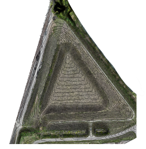
Solar Development Mapping
As part of an upcoming 6+ acre solar installation in Miamisburg, OH, AMDS was hired to provide high-accuracy site data to support pre-construction planning and grading analysis. We captured and processed the full site using a DJI Mavic 3 Enterprise with RTK workflows, delivering a 1 cm/pixel orthomosaic, DSM/DTM elevation models, and an interactive 3D surface view.
Deliverables: 3D Model • Contours • Volume Report
-
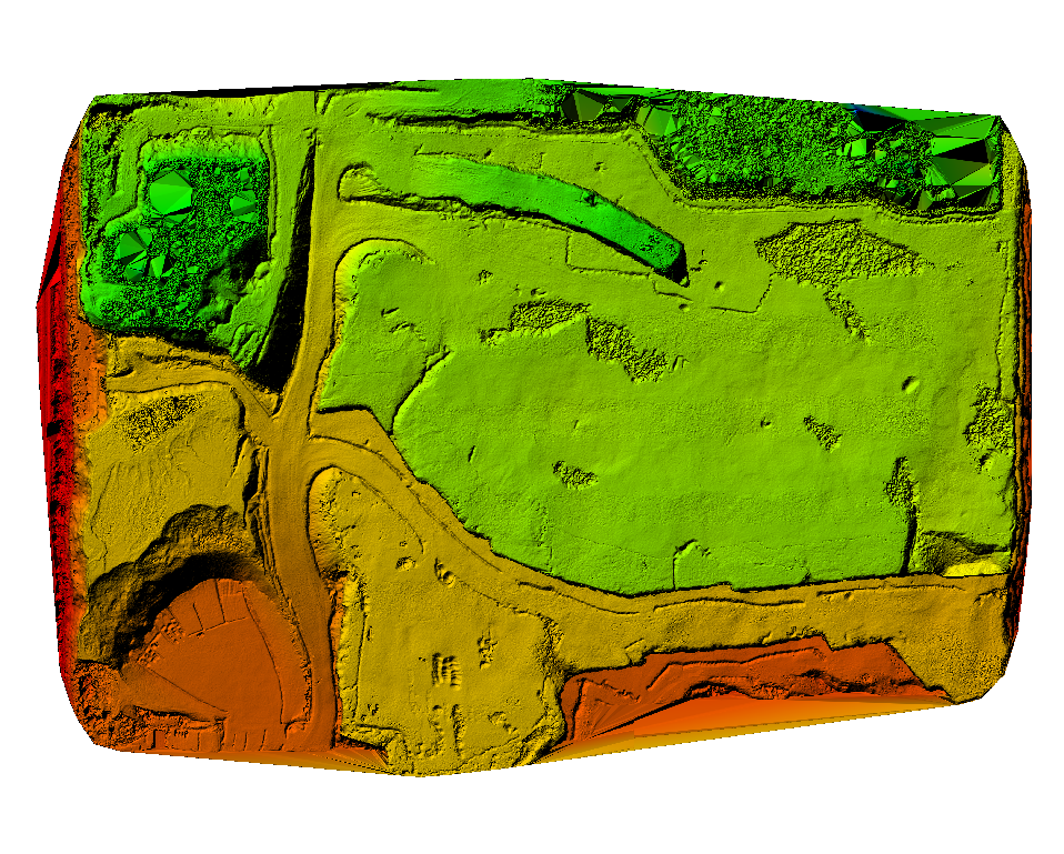
Thornton Quarry - Industrial Landform Assessment
To showcase AMDS capabilities at scale, we captured and processed this industrial site using a DJI Mavic 3 Enterprise. Located just south of Chicago, Thornton Quarry is one of the largest aggregate quarries in the world. While not a commissioned job, this demo highlights AMDS’s ability to process complex terrain and large surface areas with high precision — ideal for excavation, land planning, and volumetric analysis use cases.
Deliverables: Orthomosaic • DSM/DTM • Cut-Fill Map -
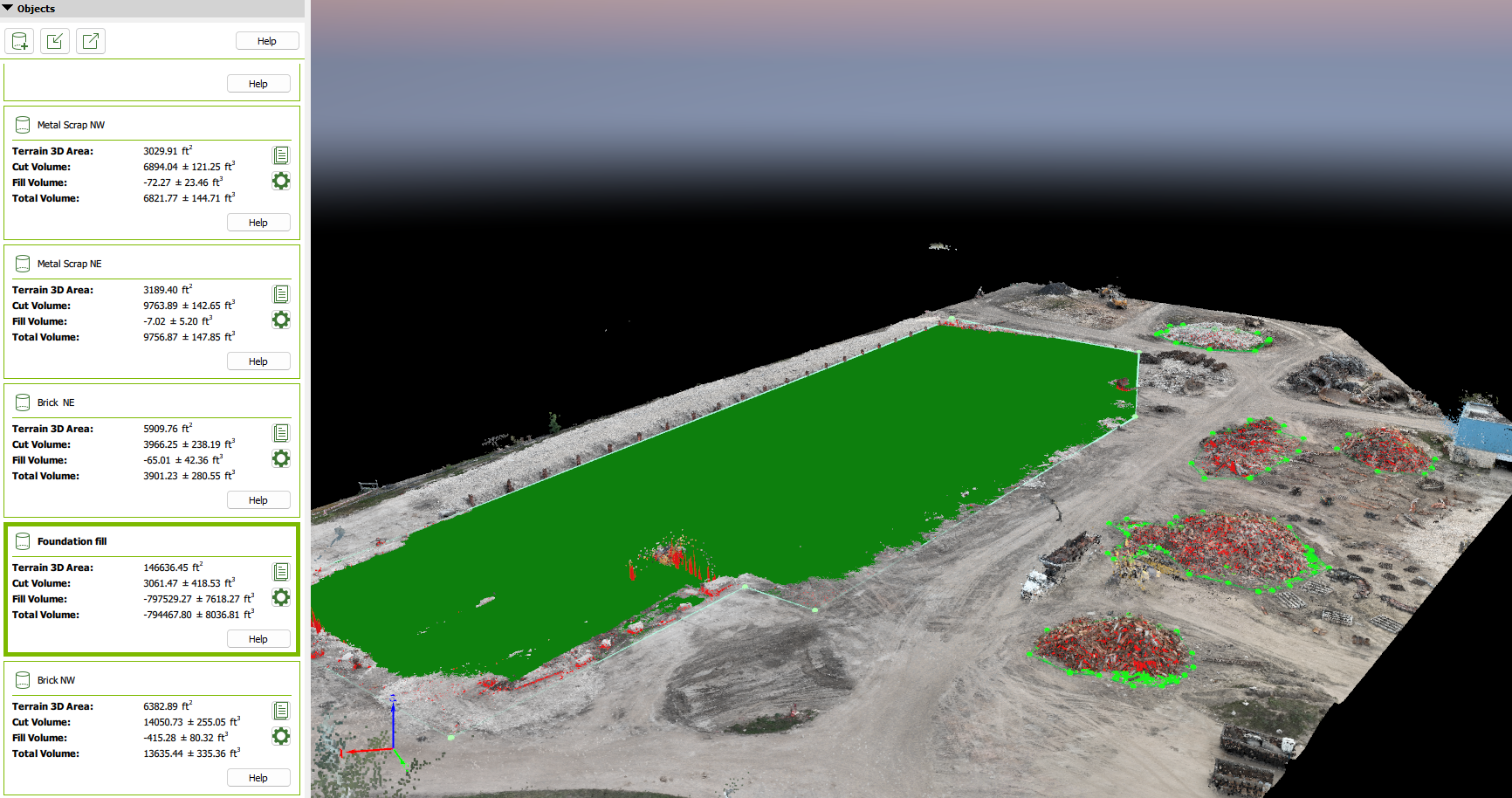
Coal Power Plant Demolition – Cut/Fill Analysis
Using RTK-enabled drone mapping and ground control across the active demolition area, we delivered a high-resolution orthomosaic, elevation models, and a detailed cut/fill report showing material movement across the site. With visual overlays and tabulated volume data, the client is able to accurately track soil removal, and validate contractor performance.
Deliverables: Cut/Fill Volume Map with color-coded overlay